PDF Preview
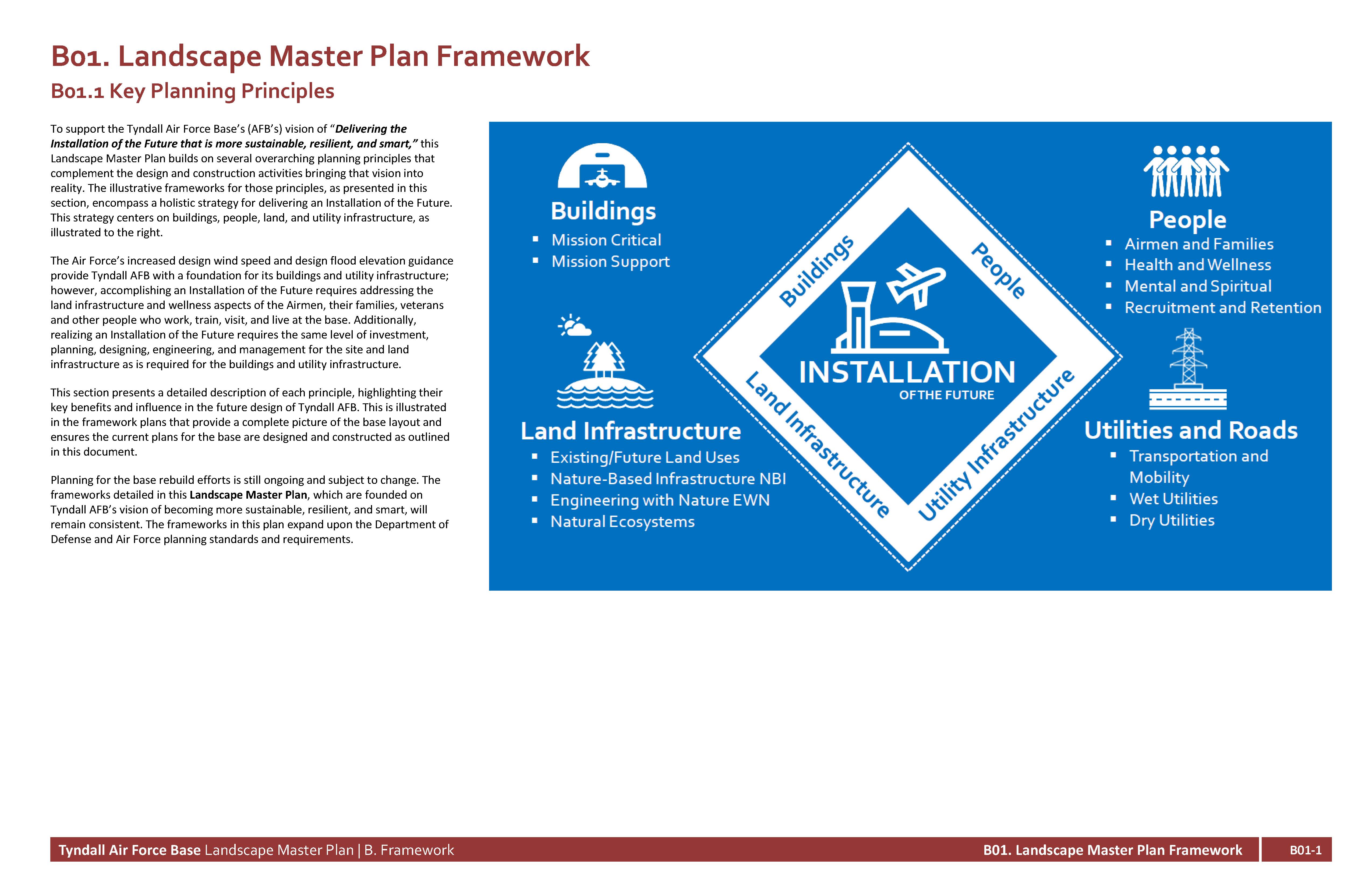
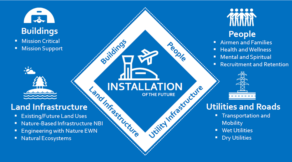
To support the Tyndall Air Force Base’s (AFB’s) vision of “Delivering the Installation of the Future that is more sustainable, resilient, and smart,” this Landscape Master Plan builds on several overarching planning principles that complement the design and construction activities bringing that vision into reality. The illustrative frameworks for those principles, as presented in this section, encompass a holistic strategy for delivering an Installation of the Future. This strategy centers on buildings, people, land, and utility infrastructure, as illustrated to the right.
The Air Force’s increased design wind speed and design flood elevation guidance provide Tyndall AFB with a foundation for its buildings and utility infrastructure; however, accomplishing an Installation of the Future requires addressing the land infrastructure and wellness aspects of the Airmen, their families, veterans and other people who work, train, visit, and live at the base. Additionally, realizing an Installation of the Future requires the same level of investment, planning, designing, engineering, and management for the site and land infrastructure as is required for the buildings and utility infrastructure.
This section presents a detailed description of each principle, highlighting their key benefits and influence in the future design of Tyndall AFB. This is illustrated in the framework plans that provide a complete picture of the base layout and ensures the current plans for the base are designed and constructed as outlined in this document.
Planning for the base rebuild efforts is still ongoing and subject to change. The frameworks detailed in this Landscape Master Plan, which are founded on Tyndall AFB’s vision of becoming more sustainable, resilient, and smart, will remain consistent. The frameworks in this plan expand upon the Department of Defense and Air Force planning standards and requirements.
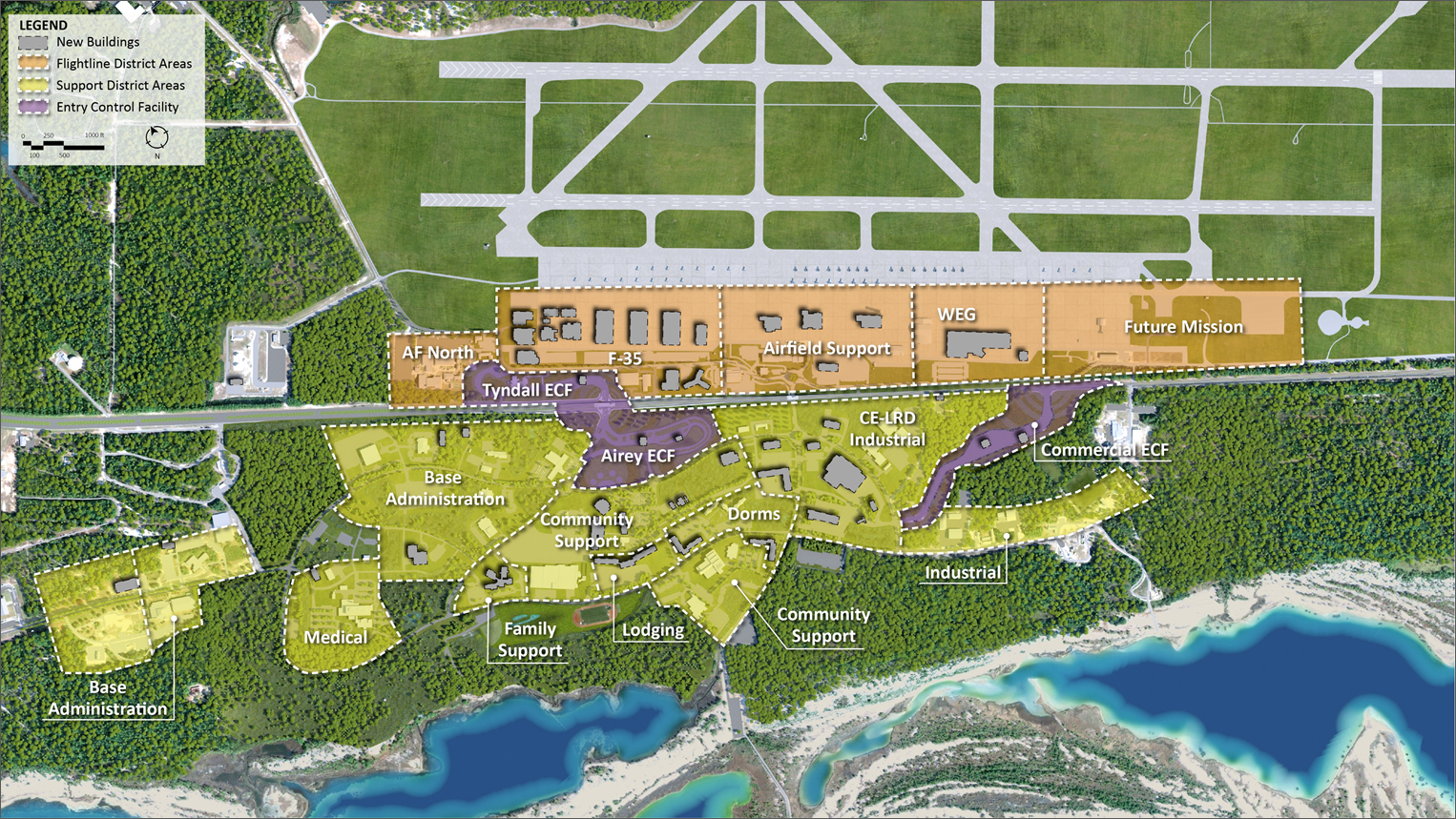
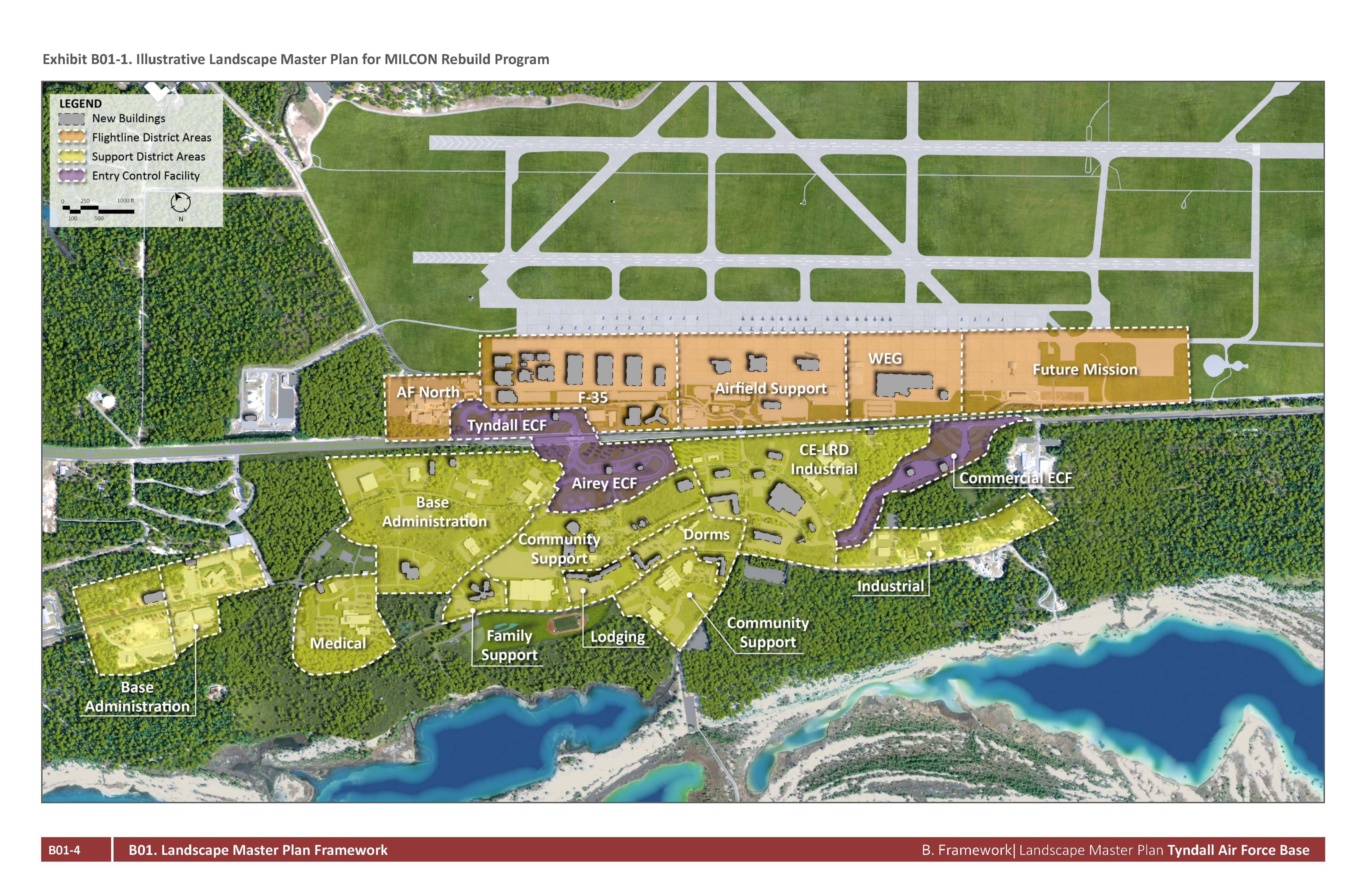
The overarching principles are presented on illustrative framework plans, which provide the basis of the physical design guidance and layout recommendations described in Section C, Site Development Criteria. See Exhibit B01-1 for the Illustrative Landscape Master Plan for the Military Construction (MILCON) Rebuild Program.
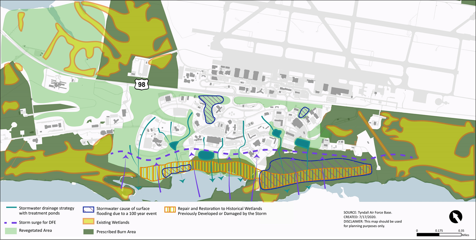
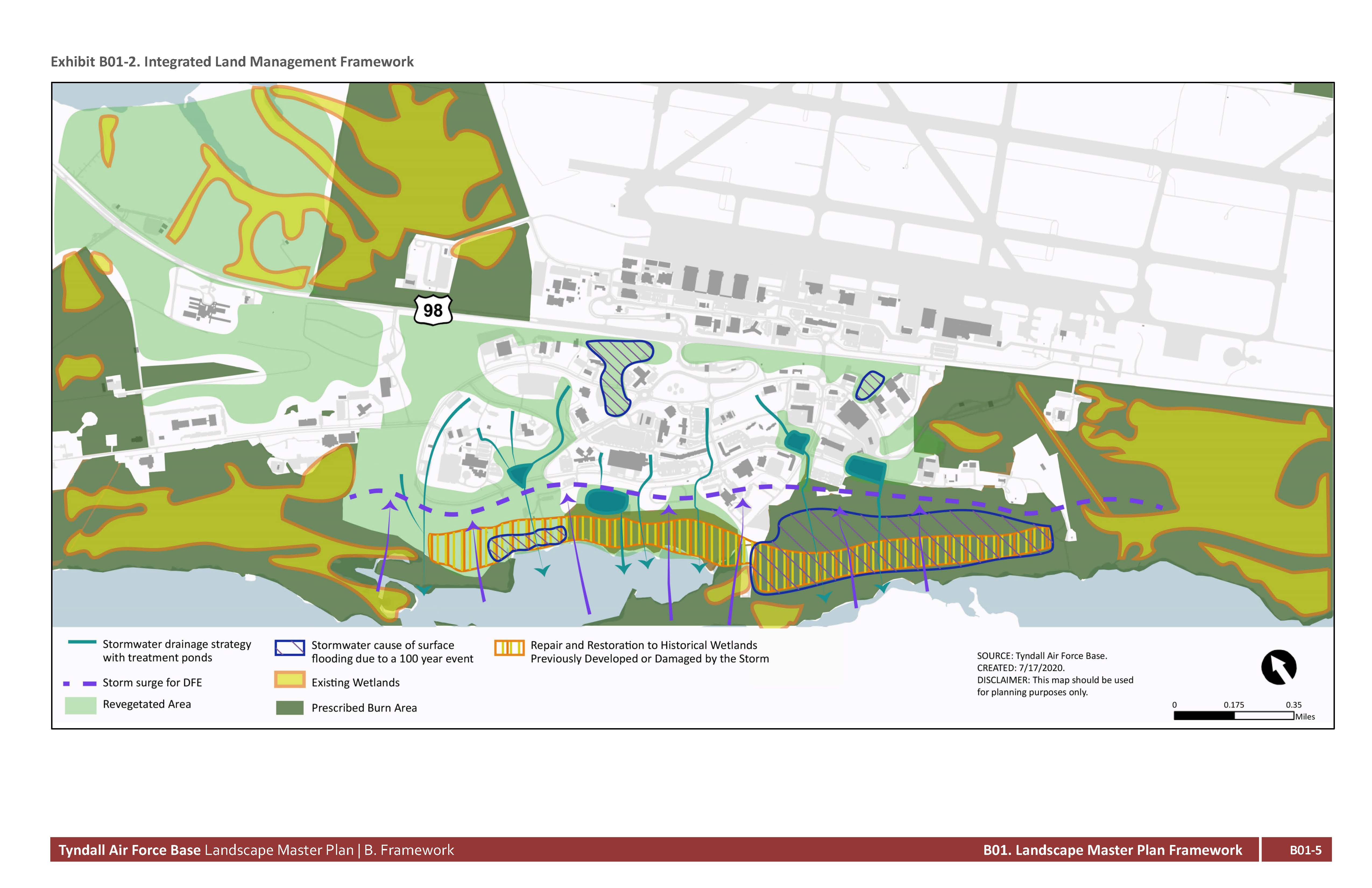
Integrated land management includes solutions that consider the holistic environment in which the project is being executed and is part of the entire system of components in which it will impact. For the main Flightline and Support Districts, the goal is to integrate and synchronize the built environment, such as building layout, road configuration, and utility routing with the natural environment such as revegetation strategies, nature-based infrastructure for stormwater management and sensitivity to coastal resiliency measures. In the main developed areas of the Flightline and Support Districts, the integrated land management strategy overlays the requirements of the Integrated Natural Resources Management Plan (INRMP). This includes the use of the approved plant pallet for revegetation to encourage native plant species and eliminate invasive species. It also reduces high landscape maintenance costs and has other non-financial benefits, such as increased shade, stormwater infiltration, and air quality. See Exhibit B01-2 for the Integrated Mobility Framework.
Integrated land management also coordinates the activities upland, with the coastal areas, to ensure the water management strategy is being considered across all land areas. This is important as it relates to mitigating coastal surge and stormwater runoff in extreme weather events.
The south side of the Support District, which is below the design flood elevation of 19 feet, is a land area that had previously been developed and had a large amount of vegetation loss after Hurricane Michael. The revegetation strategy is to encourage wetland regeneration and repair the wetland band that existed pre-development. This will also assist with the water management strategy. These revegetated areas can be multipurposed for off-road pedestrian mobility, as well.
Refer to Section B04, Integrated Land Management, for additional planning information, and Sections C02, Utilities, C04, Stormwater, and C06, Landscape, for more information about the specific typologies and elements of integrated land management.
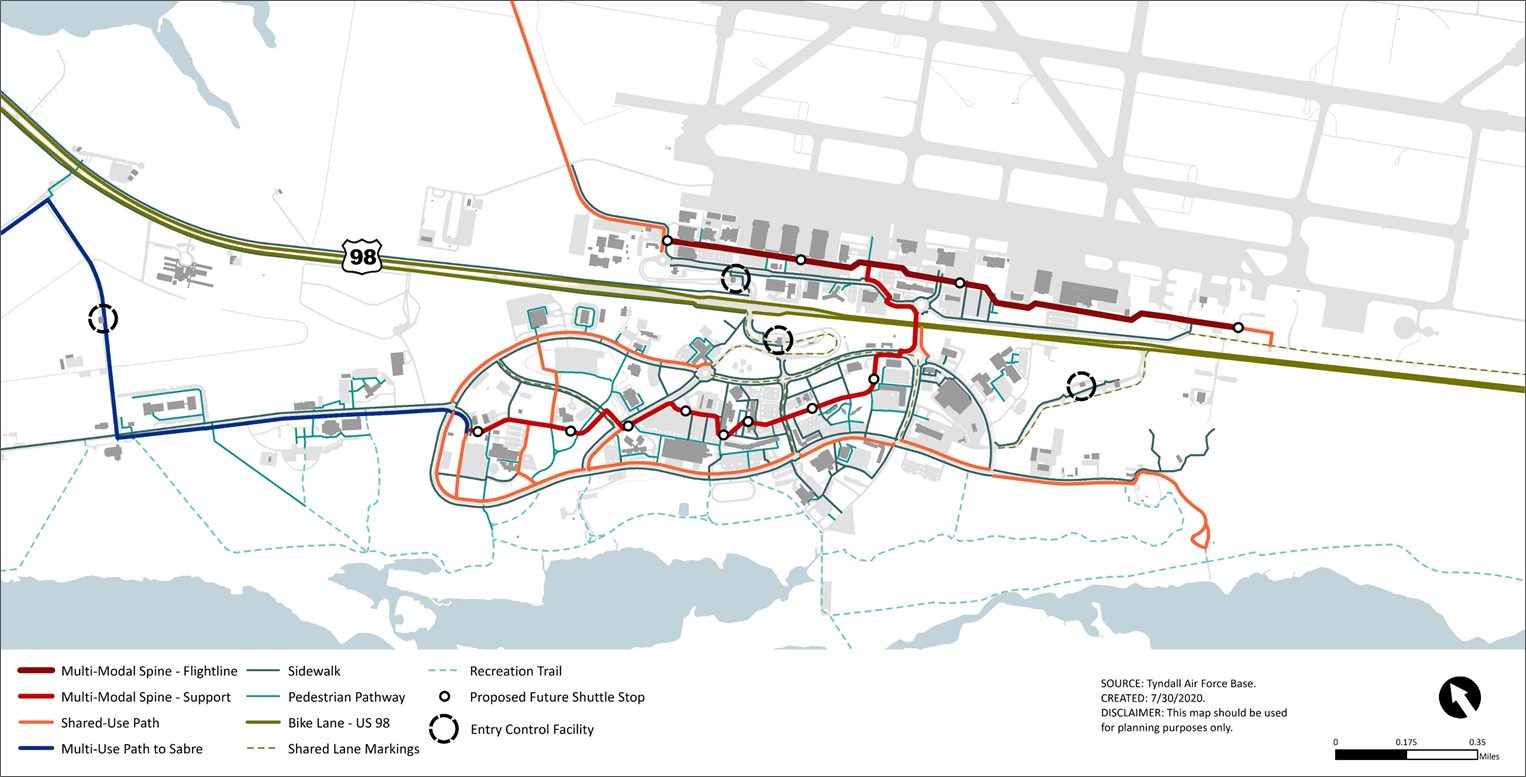
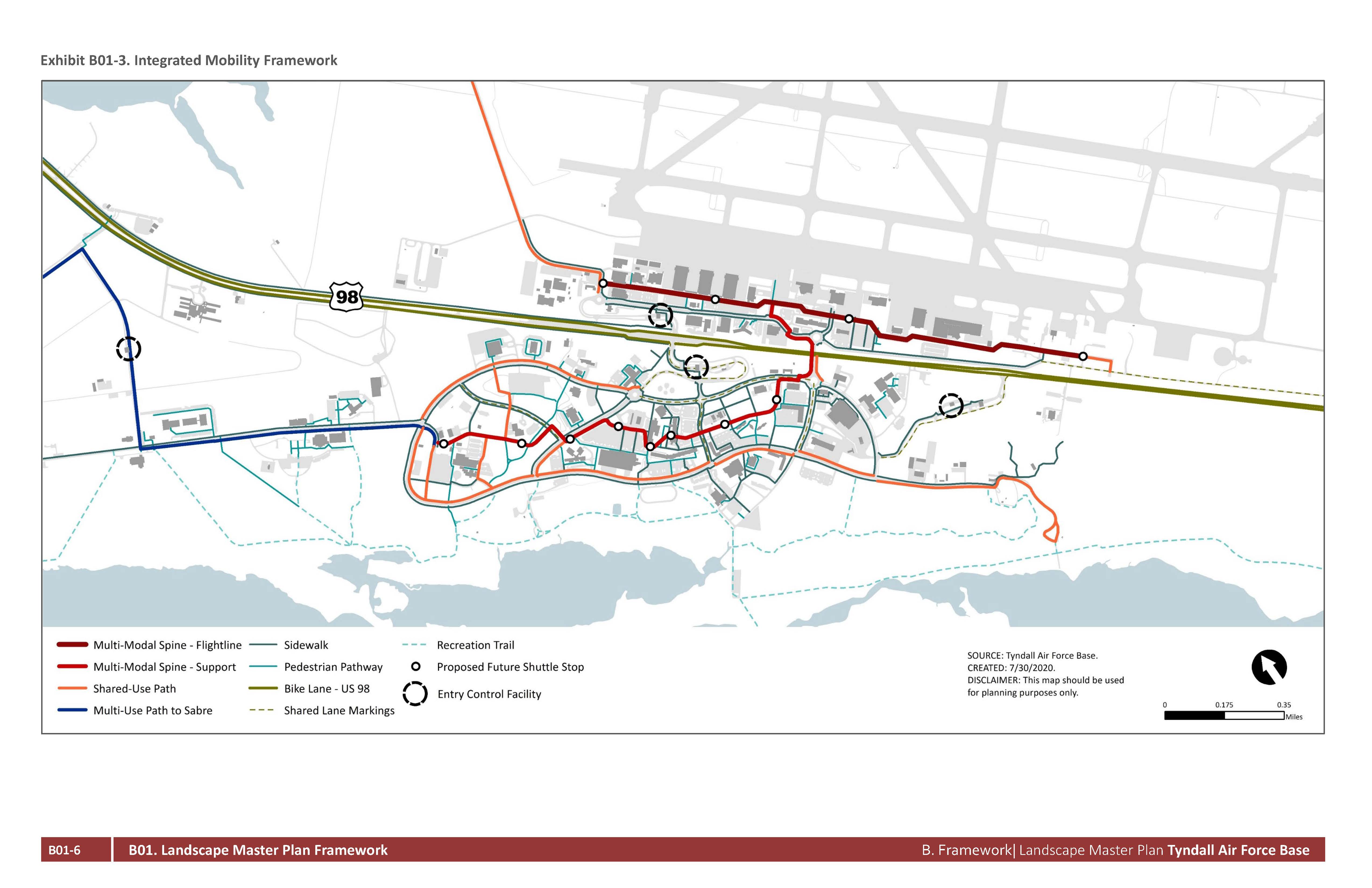
Integrated mobility considers all forms of mobility and centers the strategy on creating a walkable environment that is safe, comfortable, and appealing. It focuses the transformation of traditional roadway corridors into “complete streets” that are designed and operated for all users, including pedestrians, bicyclists, motorists and future transit riders. See Exhibit B01-3 for the Integrated Mobility Framework.
The installation-wide integrated mobility framework plan leverages regional investments in the movement of pedestrians and fosters connections through a range of mode typologies. These features are considered in reconstruction activity and amplified for all future planning activities. Refer to Section B02, Integrated Mobility Framework for additional planning information, and
Section C05, Sidewalks Pathways and Trails, for more information about the specific typologies and elements of integrated mobility.
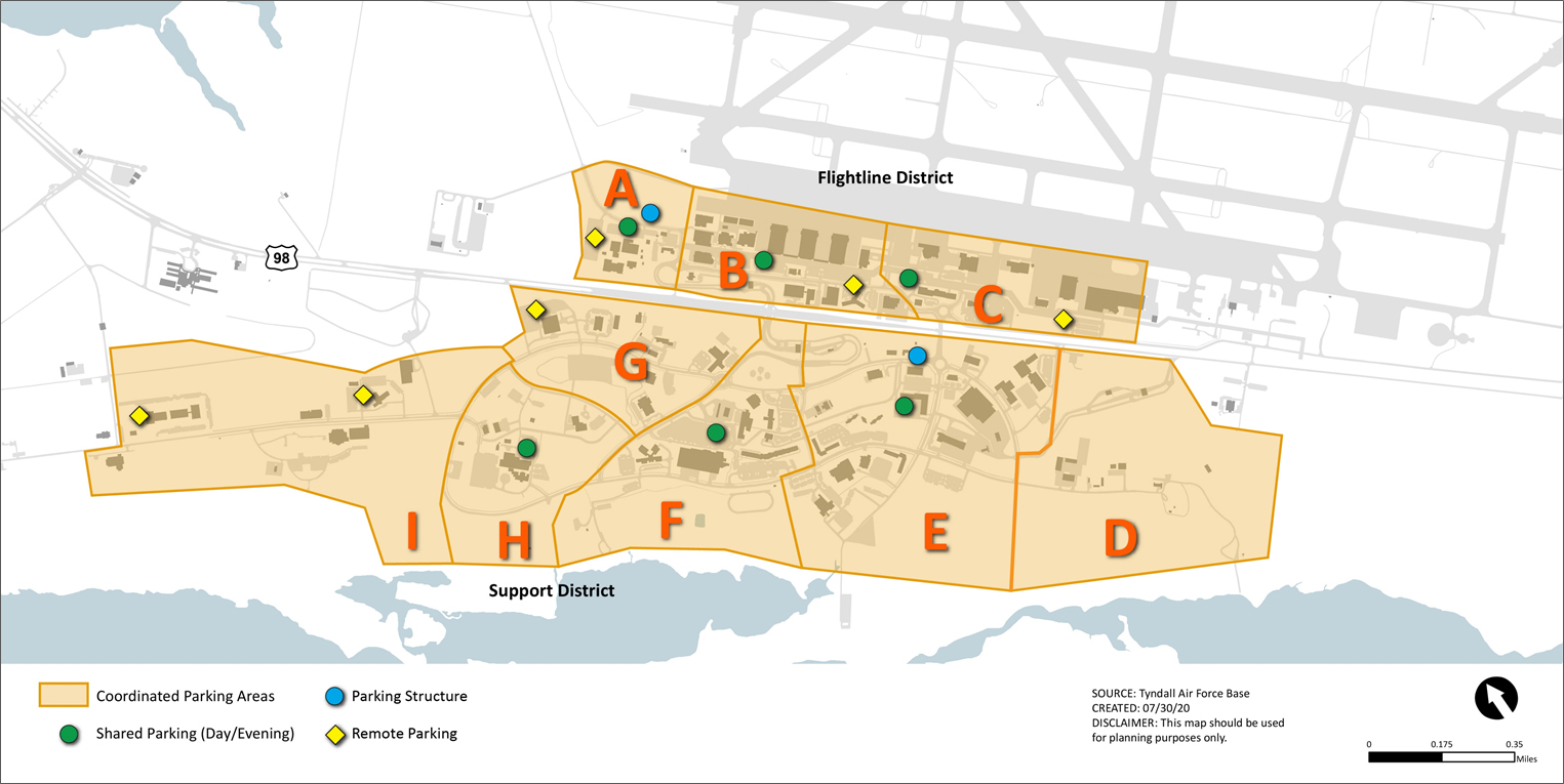
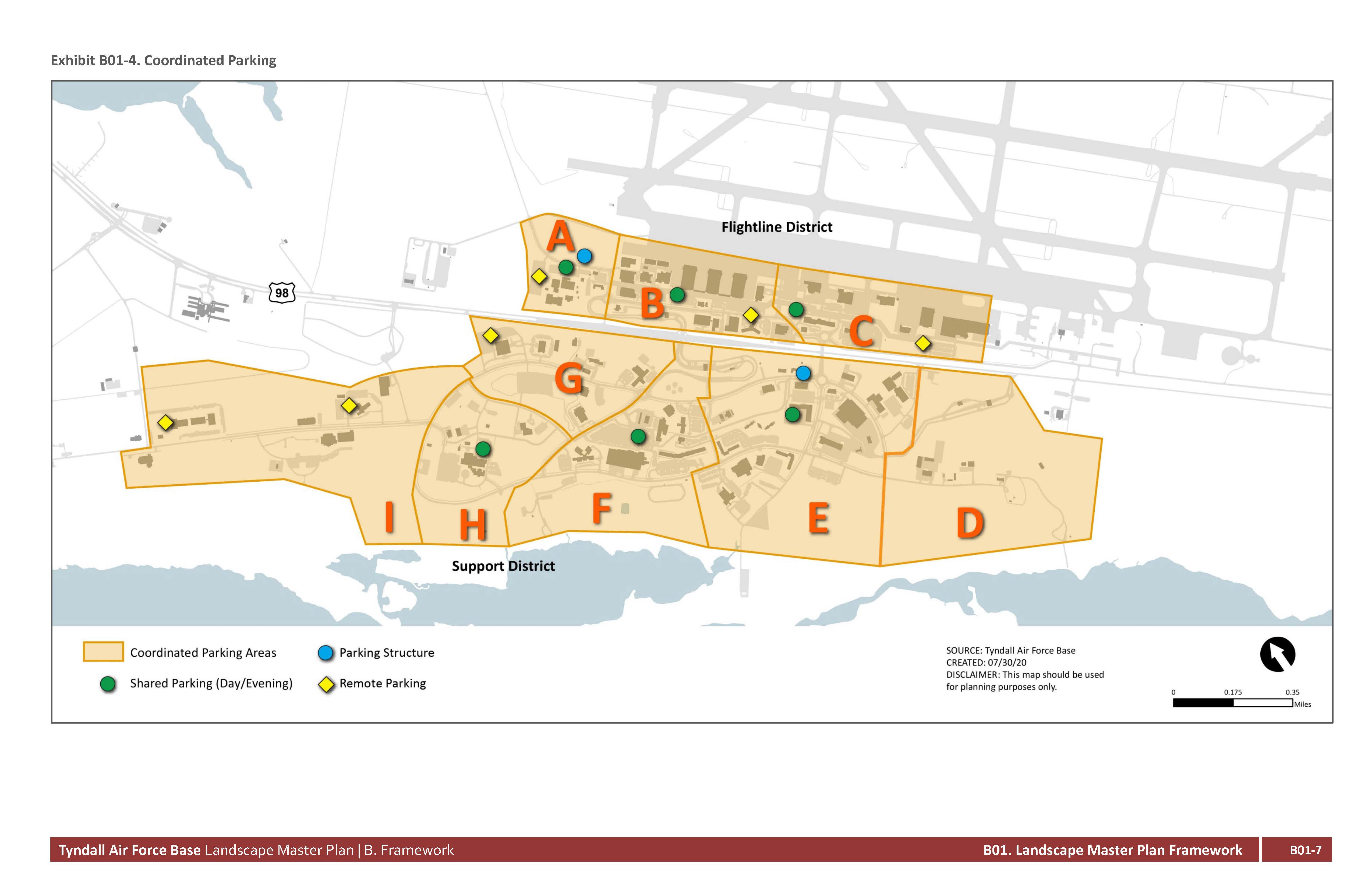
Coordinated parking encourages a holistic strategy that considers the entire parking demand for buildings that will remain as well as new construction. It considers each parking “area” as a system and does not distinguish or recognize the “Zone Boundaries” that MILCON is organized around for design and execution. It recommends solutions that avoid an overbuild of surface parking and maximizes reuse of existing parking and paved surfaces. This requires a high level of coordination and design integration.
The goal is to maximize parking efficiency and meet the UFC parking requirements without overbuilding surface parking by being building-centric in the application of parking. There are several solutions to achieve this goal that are defined by the following typologies:
Refer to Section B03, Coordinated Parking, for additional planning information, Section C03, Parking Areas, for more information about the specific typologies and elements.
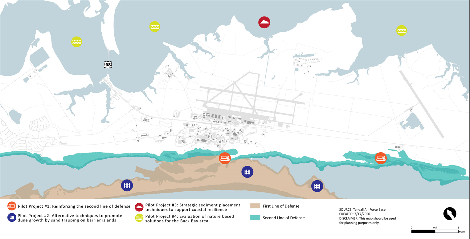
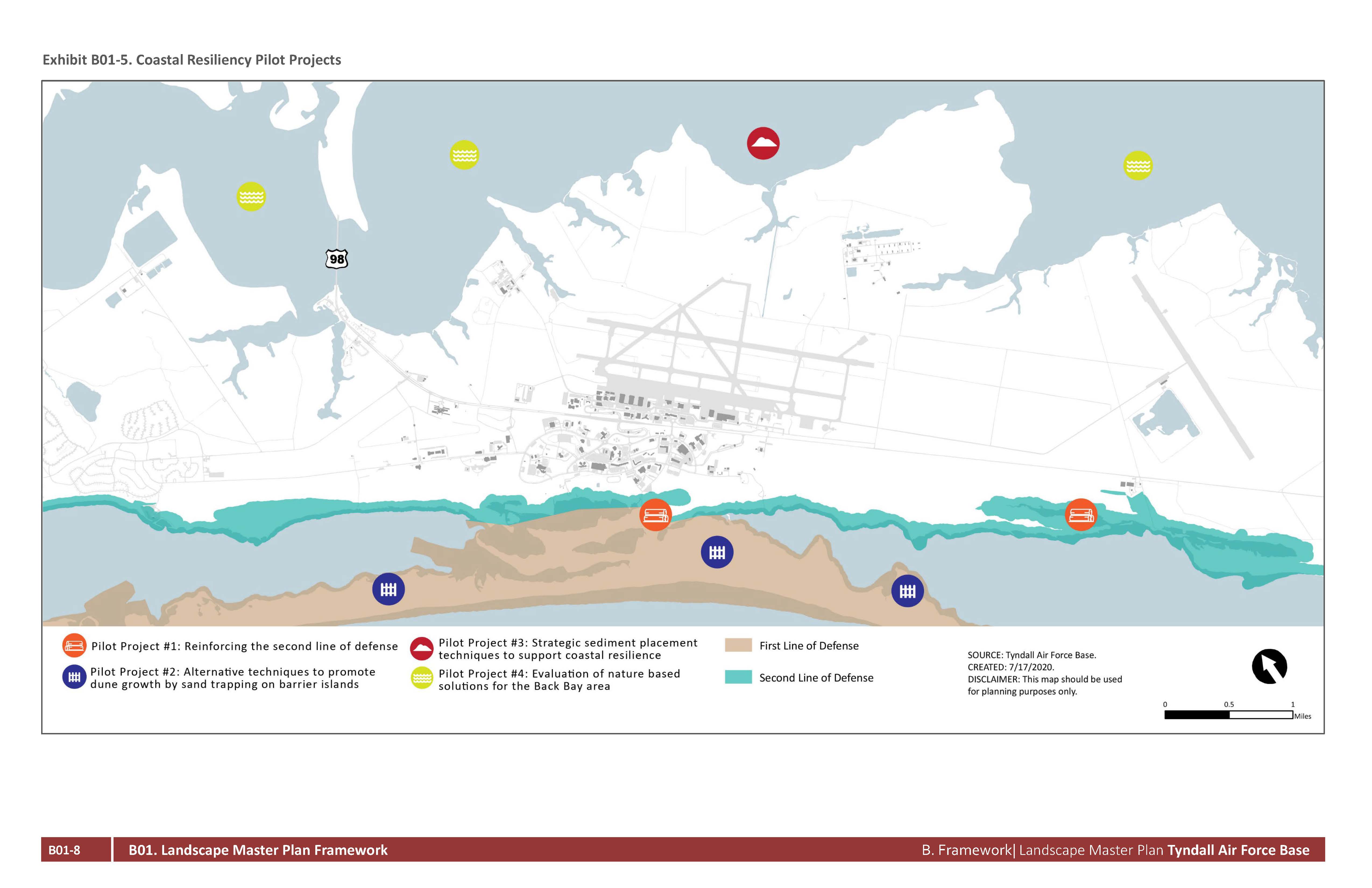
Coastal resiliency is critical to achieve mission assurance at Tyndall AFB. The MILCON program is required to adhere to two major design memorandums issued by Headquarters, Department of the Air Force:
To address the coastal resiliency aspects that are not covered by these two memorandums, a case study was executed to evaluate the opportunity to engage resources in the form of funding, in-kind support, technical support, or other measures from external stakeholders to support the implementation of nature-based coastal resilience solutions at Tyndall AFB.
Nature-based coastal resilience solutions are particularly attractive because, in the correct settings, they can be less costly, more self-maintaining, and offer a range of co-benefits associated with nature habitats. These co-benefits include the provision of habitat for threatened/endangered species and areas for recreational opportunities. Nature-based solutions can be used alone or in combination with other approaches to provide multiple lines of defense against storm surge. Another benefit of nature-based solutions is that they are attractive to a range of stakeholders, which could potentially open up new sources of funding. The large areas of varied coastal and back bay habitats surrounding Tyndall AFB provide an excellent opportunity to deploy a range of types of nature-based coastal resiliency solutions.
A recent case study developed four pilot studies to explore the viability of nature-based coastal resiliency solutions at Tyndall AFB. The pilot project descriptions were developed in two meetings in October and December 2019, with input from The U.S. Air Force, U.S. Fish and Wildlife Service, U.S. Army Corp of Engineers, and Jacobs. The four pilots that were developed are:
The coastal resiliency projects are presented on Exhibit B01-5. Refer to Section B05, Coastal, for additional planning information. Coastal criteria are also included in each part of Section C, Site Development Criteria.
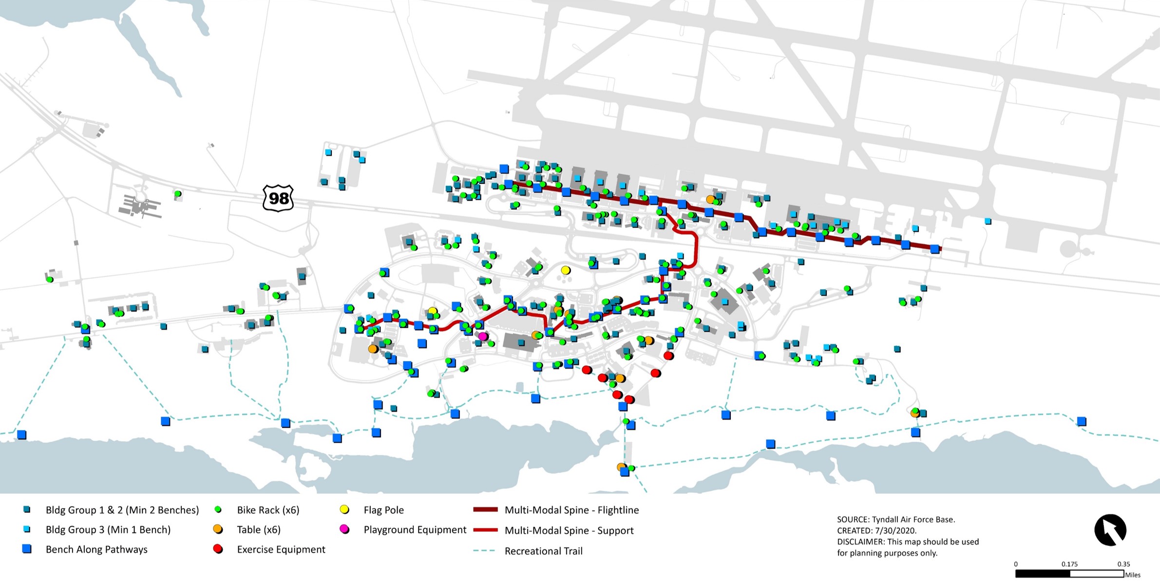
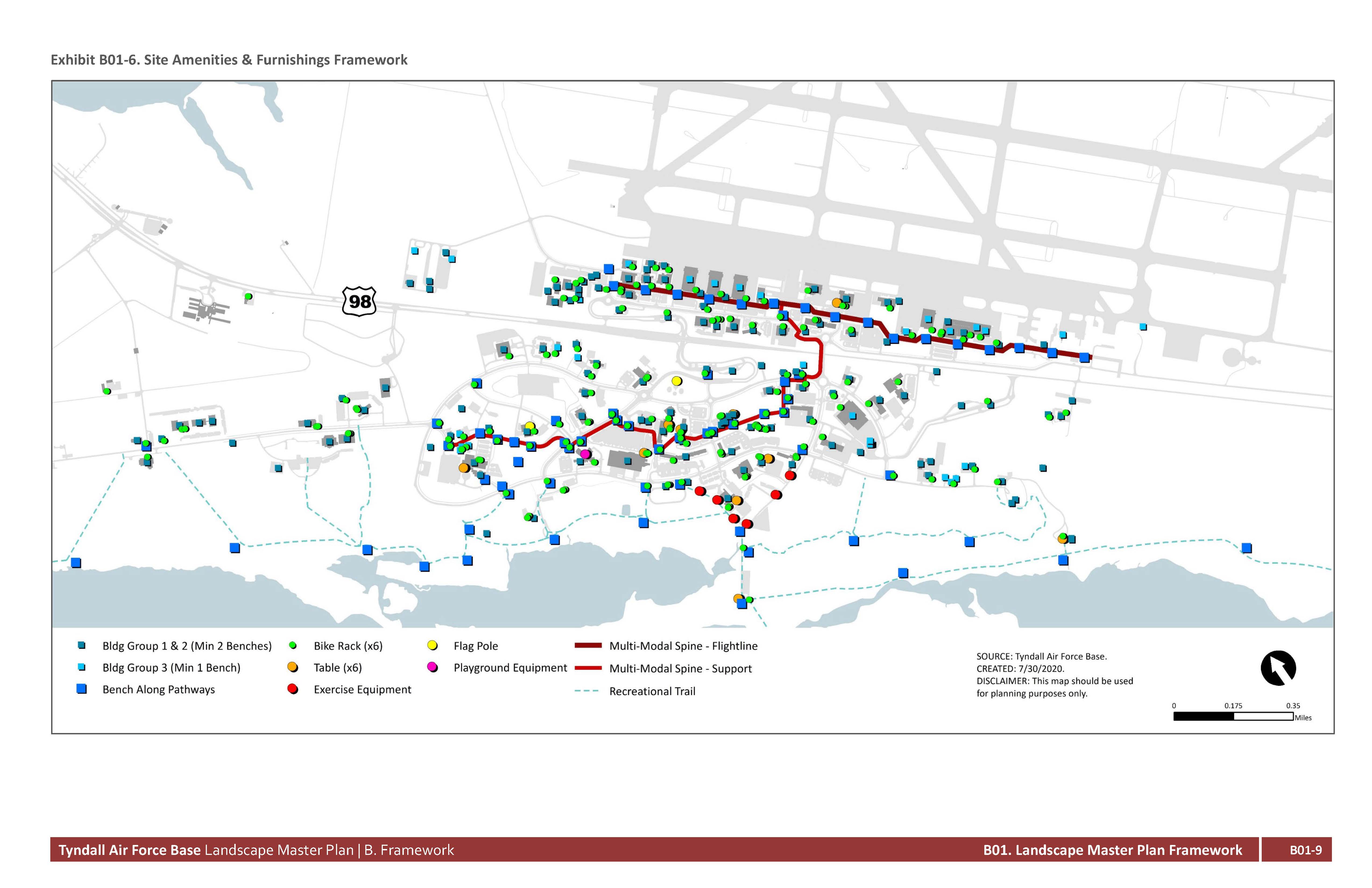
The image, character, and performance standards outlined for the site amenities and furnishings have been selected specifically for Tyndall AFB to match the architectural design intent and specific weather and climate conditions on the coast of Florida. Special considerations are given for corrosion, sea water inundation, and high sun exposure. See Exhibit B01-4 for the Site Amenities & Furnishings Framework.
The site amenities and furnishings framework is built on the mobility framework and targeting nodes of likely pedestrian gathering areas. It corresponds to the requirements for site furnishings depending on the group or type of building, sustainability measures such as encouraging bicycling through provision of bike racks and key times of reveille where the flag is raised or lowered in ceremonial areas.
There is a specialty area for playground equipment located at the Child Development Center, which is the only location where this exists in the main area of the base.
Near the Physical Fitness Center and Oasis, there will be areas where exercise equipment is placed along a circuit path for physical training requirements.
Refer to Section C07, Site Furnishings, for more information about the specific typologies and elements.
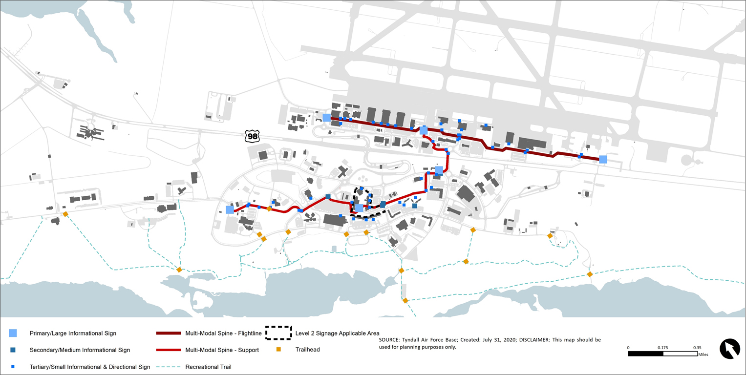
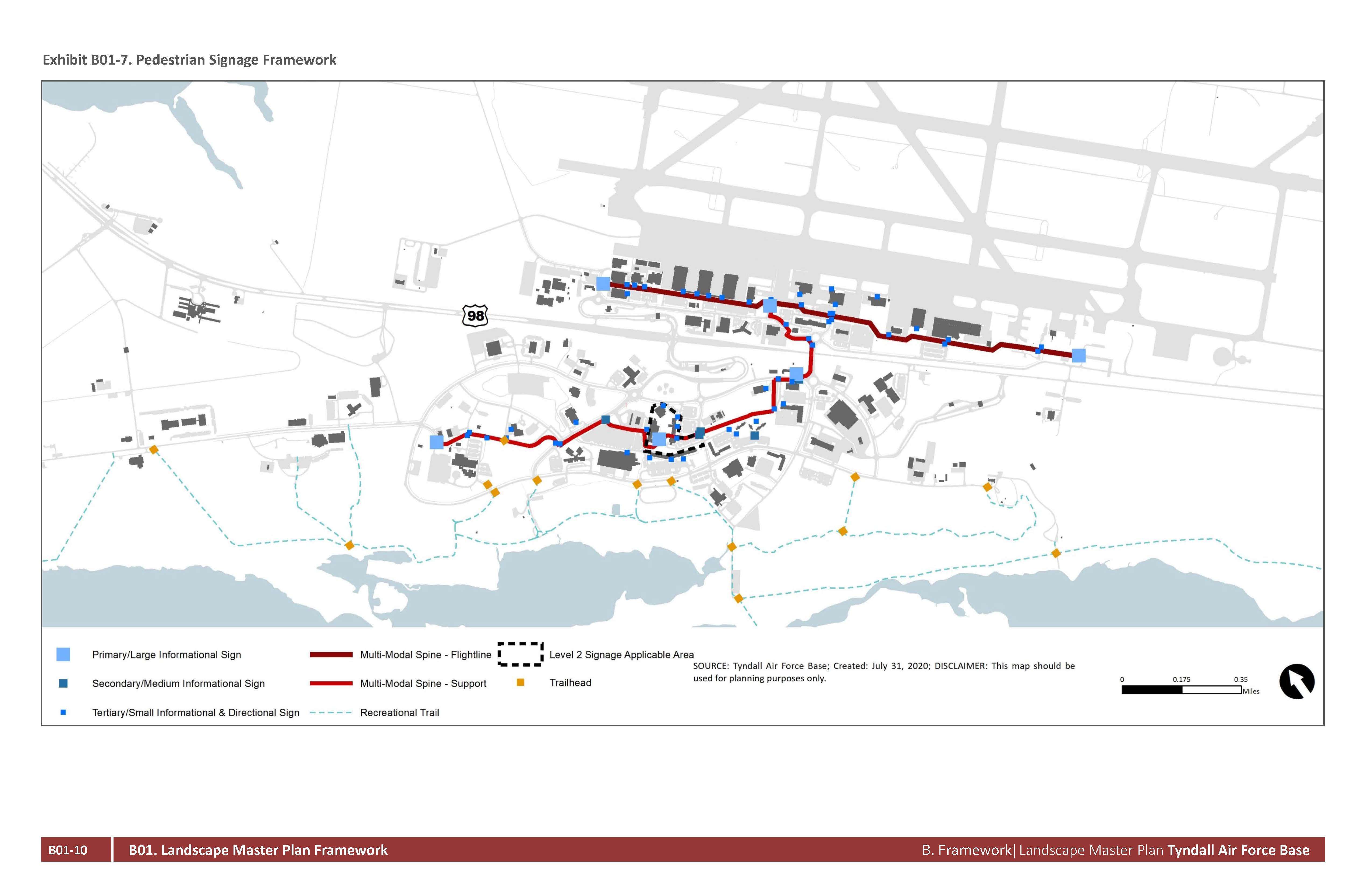
Tyndall AFB has a unique opportunity to create a pedestrian-centric installation design that promotes non-vehicular travel between mission facilities and base amenities. The pedestrian signage planning objectives are centered on the UFC and expands the general requirements to the extent necessary to add clarity to the requirements for overall signage planning. The intention is to align the signage with the architecture and site furnishings to create a “family” of site amenities. The pedestrian signage is intended to increase the ease of wayfinding and navigation, clearly identify walking and biking routes, and encourage a walkable environment. See Exhibit B01-5 for the Pedestrian Signage Framework.
The pedestrian signage framework is concentrated on signage in dedicated pedestrian pathways that may vary from the traditional vehicular dominated roadway network that is not covered by the UFC. The locational strategy is focused on areas such as building entryways, intersections with high pedestrian crossings, gathering nodes and recreational trails. The image and character is influenced by the architectural design guidelines and should comply with the increased wind load standards for high wind events. The signage approach reflects Tyndall AFB’s commitment to creating a multi-modal environment.
Refer to Section C08, Pedestrian Signage, for more information about the specific typologies and elements.
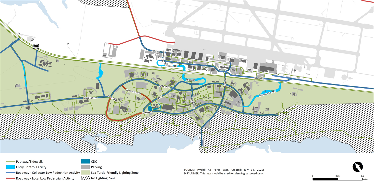
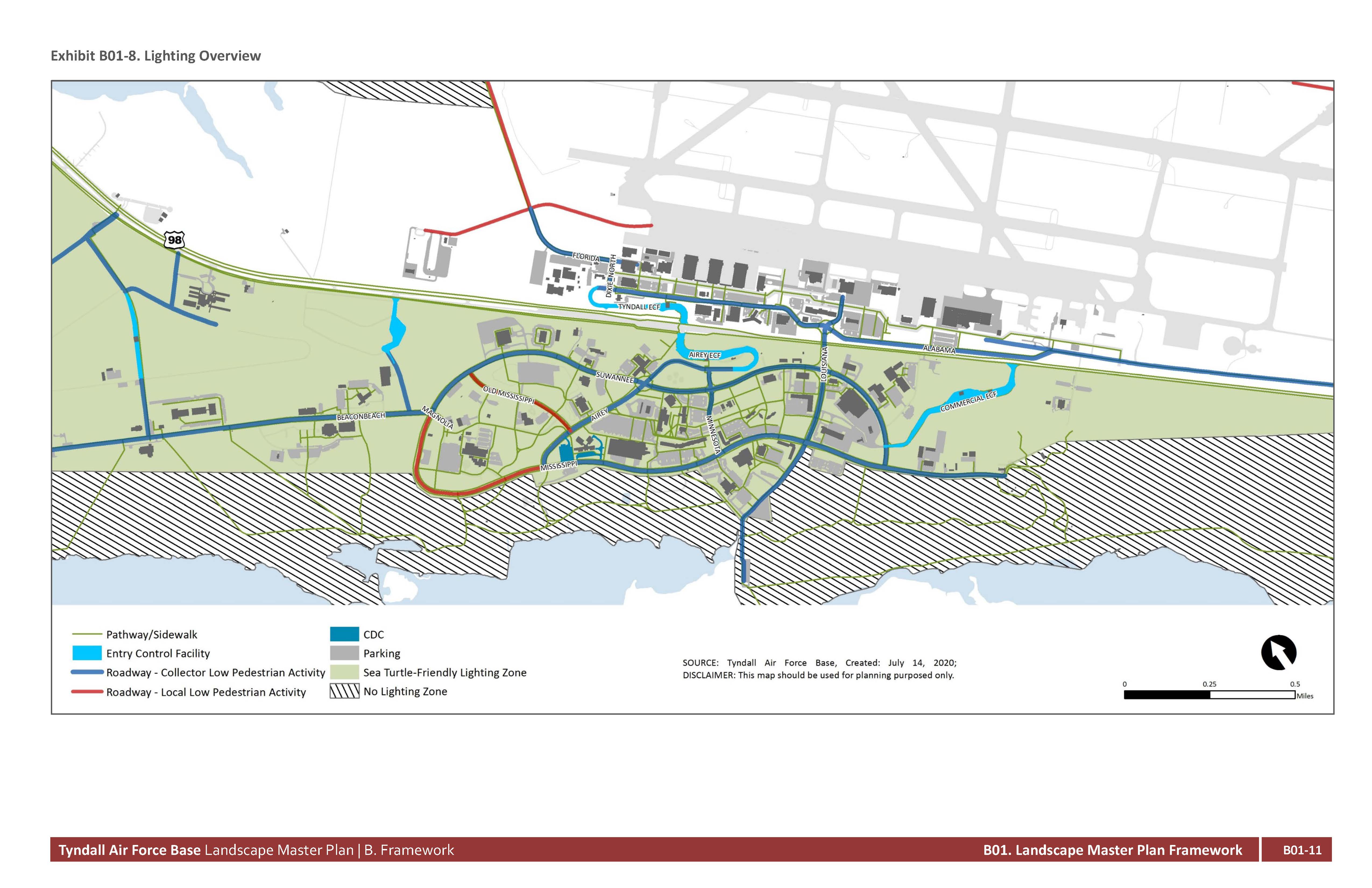
The lighting plan must be carefully coordinated due to the necessary balance between the base’s coastal environment requirements, which has special considerations, and the high security requirements of a military installation. First and foremost, Tyndall AFB is tied to National Security, yet that must be achieved in a manner that does not negatively impact the sensitive coastal habitat. This document addresses lighting criteria in the Flightline support areas, but not the Flightline specifically, as well as in the Support District.
Three distinct lighting zones are outlined:
Highly specialized areas such as the Flightline are not addressed in this document
The lighting typologies that are specified for both the Flightline District support areas and the Support District are related to:
Exhibit B01-8 presents the lighting plan overview. Refer to Section C09, Lighting, for more information about the specific typologies and elements.