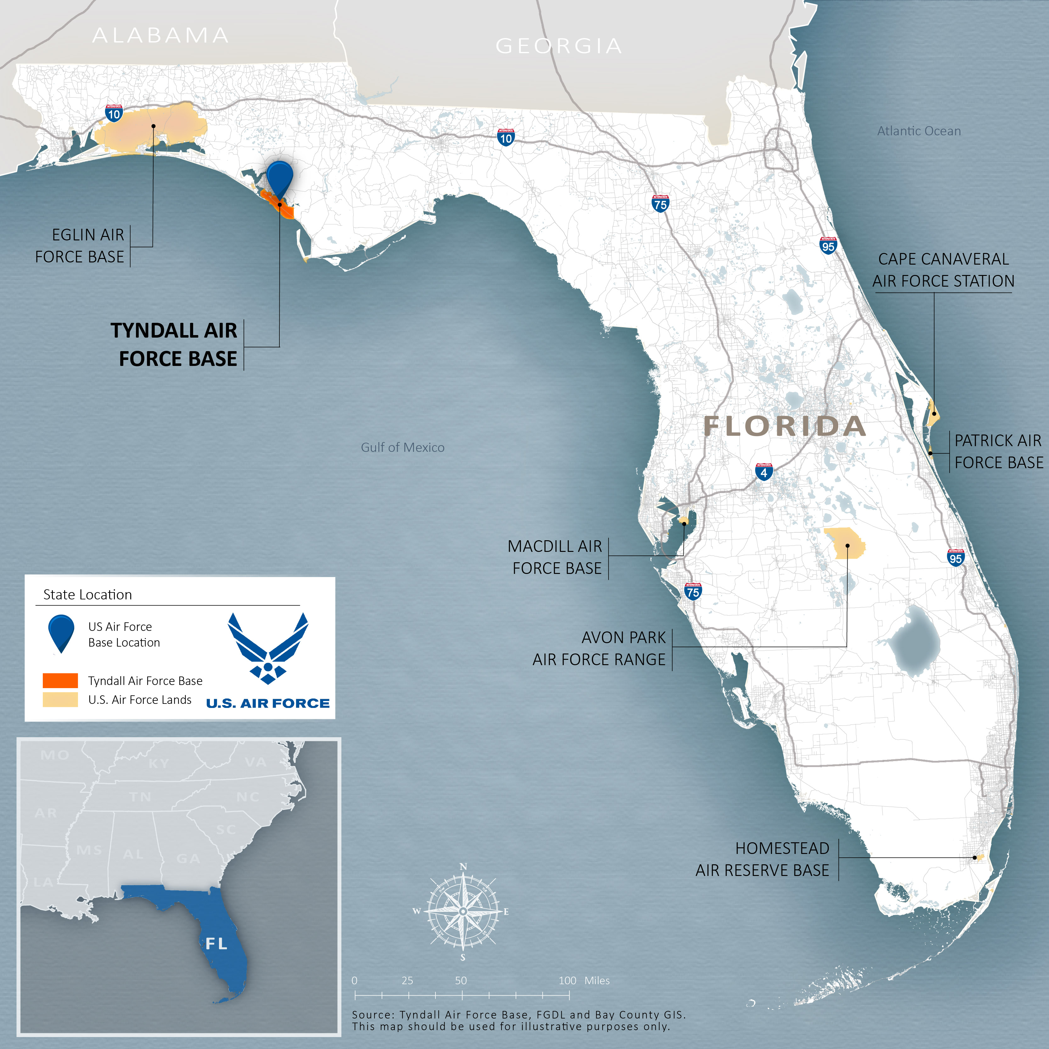
STATE LOCATION
There are four USAF installations in Florida: Eglin, MacDill, Patrick, and Tyndall. In addition, USAF operates field offices, stations, ranges, and reserve bases to support the missions of the Armed Forces in this coastal state. Tyndall AFB is located on Florida’s northwest coast, near Panama City in Bay County and along the Gulf of Mexico.
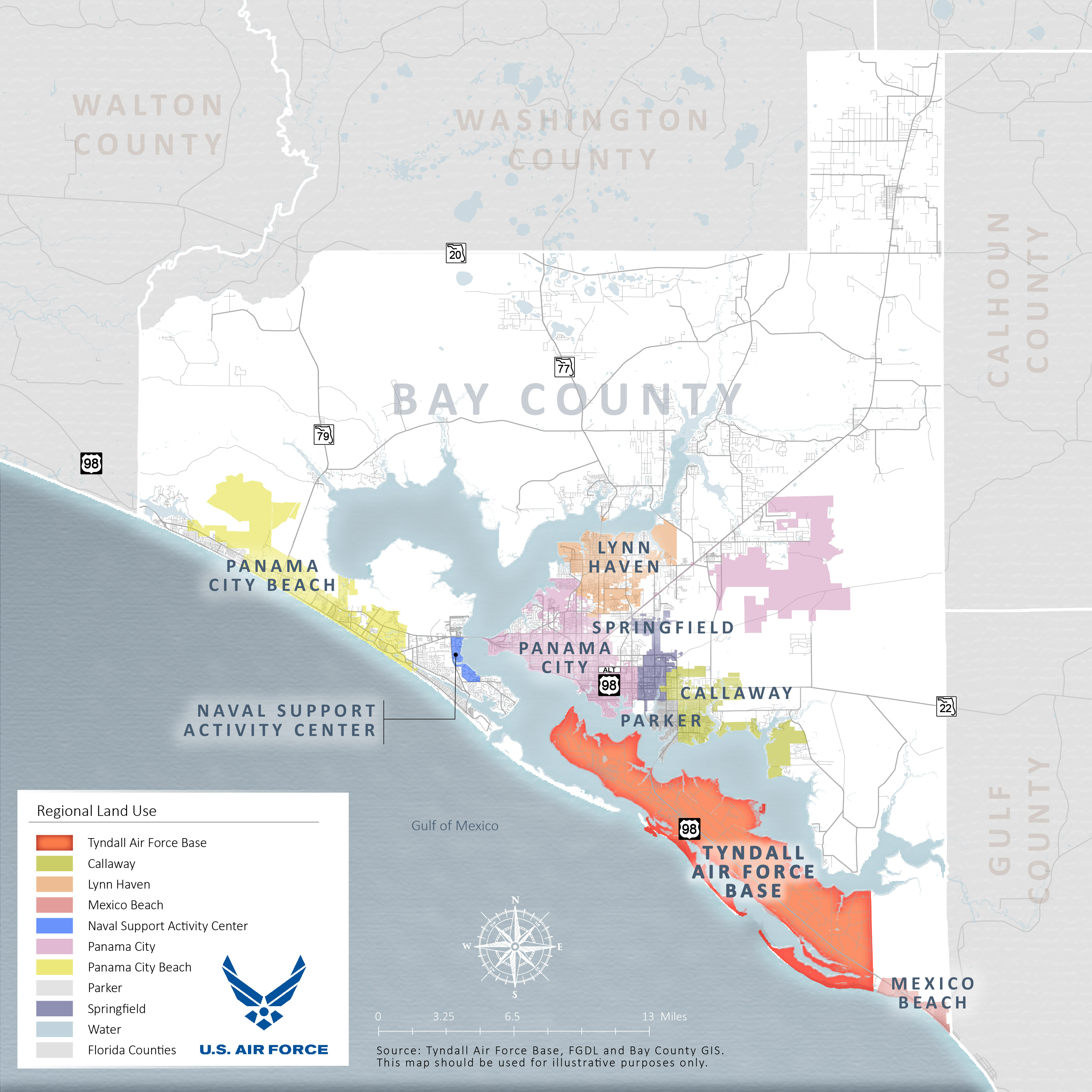
REGIONAL LOCATION
Tyndall AFB has been identified as a strategic installation by the Armed Forces of the U.S., specifically for its location along the coast to support associated airspace rights over the Gulf of Mexico. In total, Tyndall AFB comprises of approximately 30,000 acres, including wetlands and natural spaces.
Tyndall AFB is located within the Panama City metro area (population 37,000), which comprises Panama City and Panama City Beach, Parker, Callaway, Springfield, Lynn Haven, and Mexico Beach. The cities are a mix of residential, commercial, and industrial land uses. The Federal government is the largest employer in the metro area, with Tyndall AFB providing a significant number of jobs. Additionally, tourism plays a major role in the local economy. Most land outside the municipalities and adjacent to Tyndall AFB is zoned for agricultural purposes.
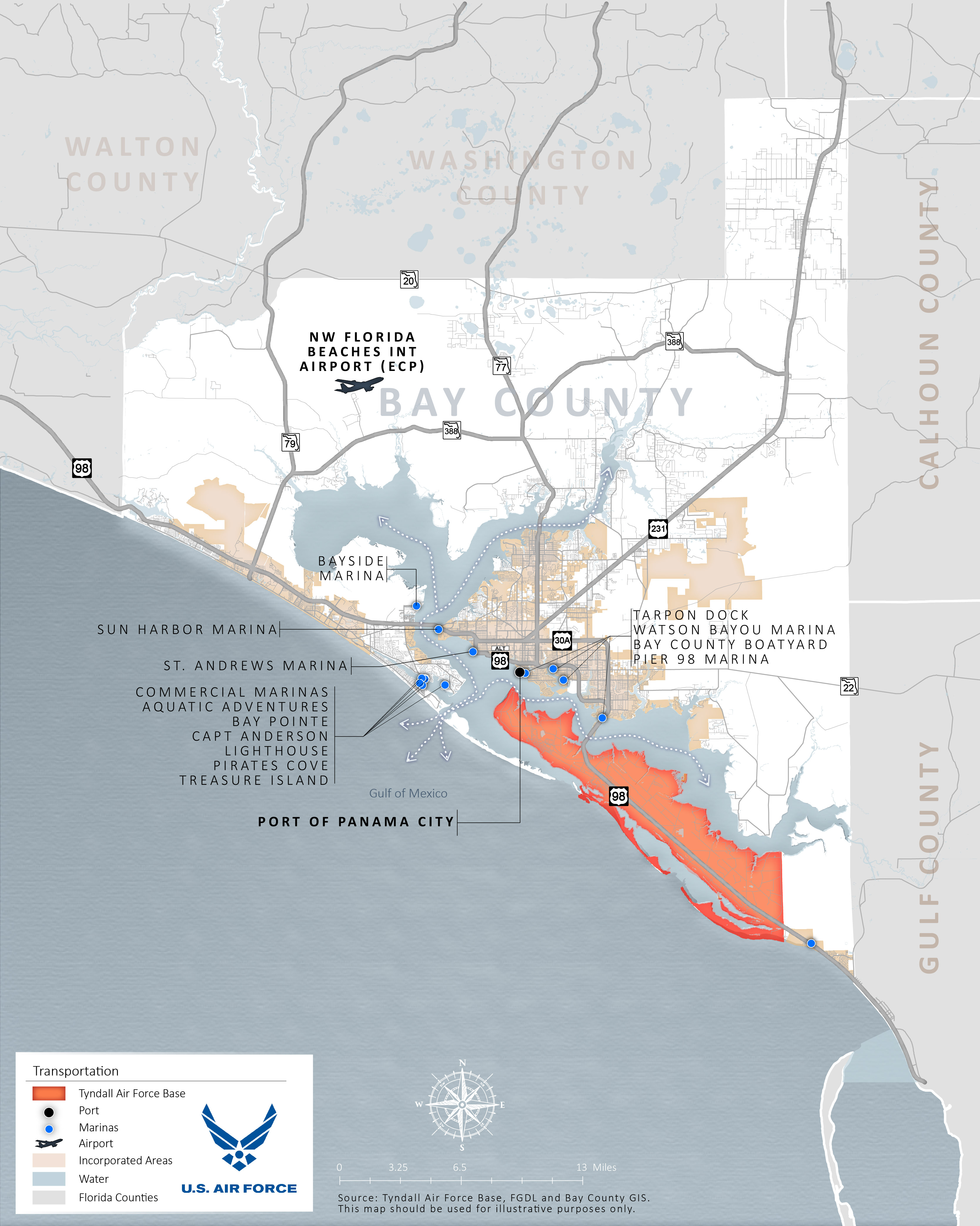
TRANSPORTATION CONTEXT
The installation is situated on a peninsula with East Bay to the north and the Gulf of Mexico to the south. Main access to the installation is via U.S. Highway 98, which connects Tyndall AFB to Panama City via a causeway. U.S. Highway 98 continues east from Tyndall AFB to Mexico Beach and other locations along the Florida panhandle. Improvements to U.S. Highway 98 are planned by the Florida Department of Transportation, including two overpasses within the Tyndall AFB footprint (Tyndall/Airey and Louisiana). The Tyndall/Airey overpass will include a single point interchange providing access to/from the Tyndall and Airey entry control facilities. The overpass at Louisiana will not include any access to/from U.S. Highway 98 but will allow installation traffic to pass under the highway while staying within the secured perimeter of Tyndall AFB. The Port of Panama City serves as the nearest seaport to Tyndall AFB while NW Florida Beaches International Airport serves as the nearest primary airport with more than 500,000 enplanements in 2018.

EVACUATION ROUTES
Bay County is considered an emergency evacuation zone by state authorities, and the streets shown in blue have been designated as evacuation routes.
U.S. Highway 98, which bisects Tyndall AFB, is part of an emergency evacuation route.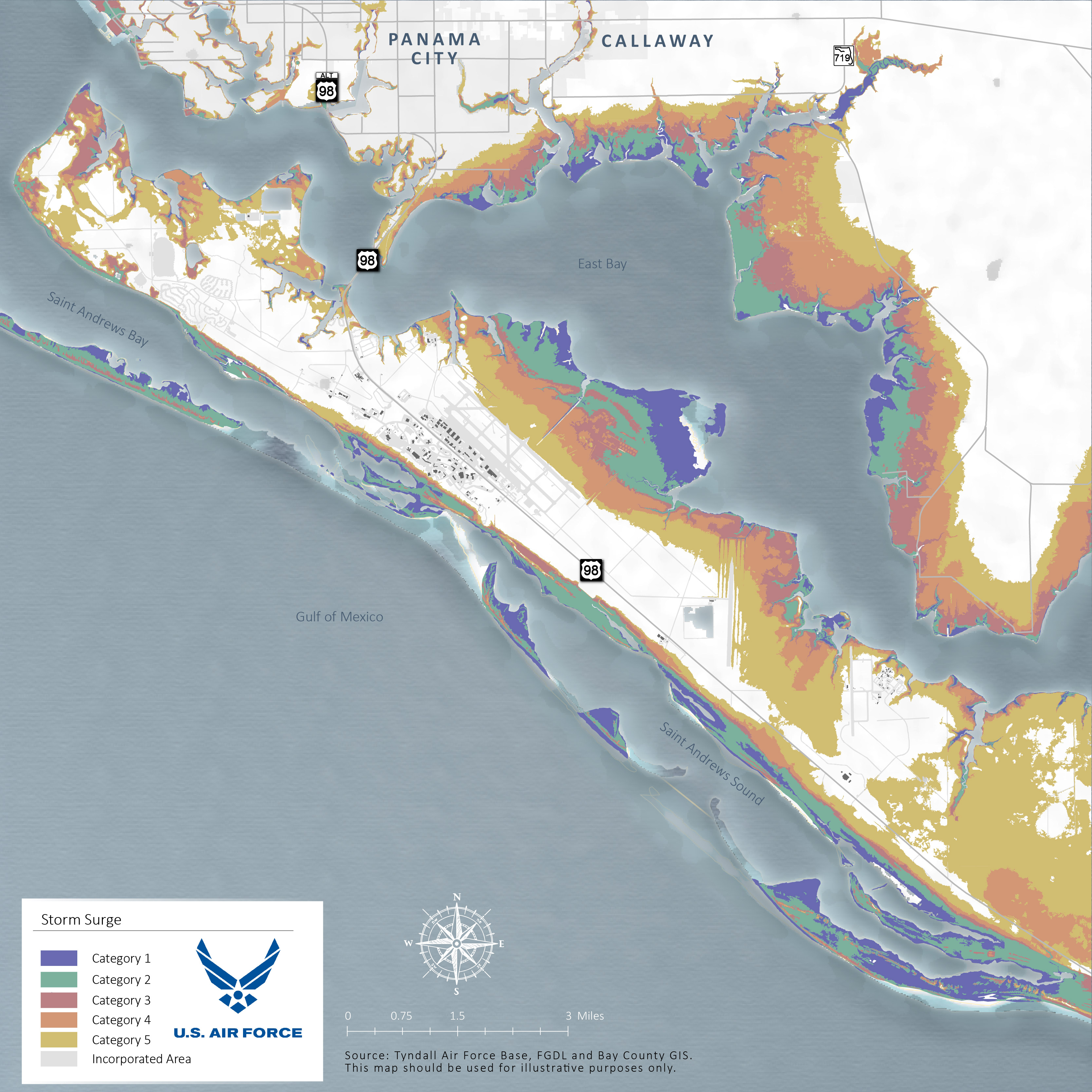
STORM SURGE
The storm surge from a Category 5 event such as Hurricane Michael produces walls of water greater than 9 feet in height when making landfall. It can be particularly devastating in Tyndall AFB’s case because water surges from both the coast and the bay.
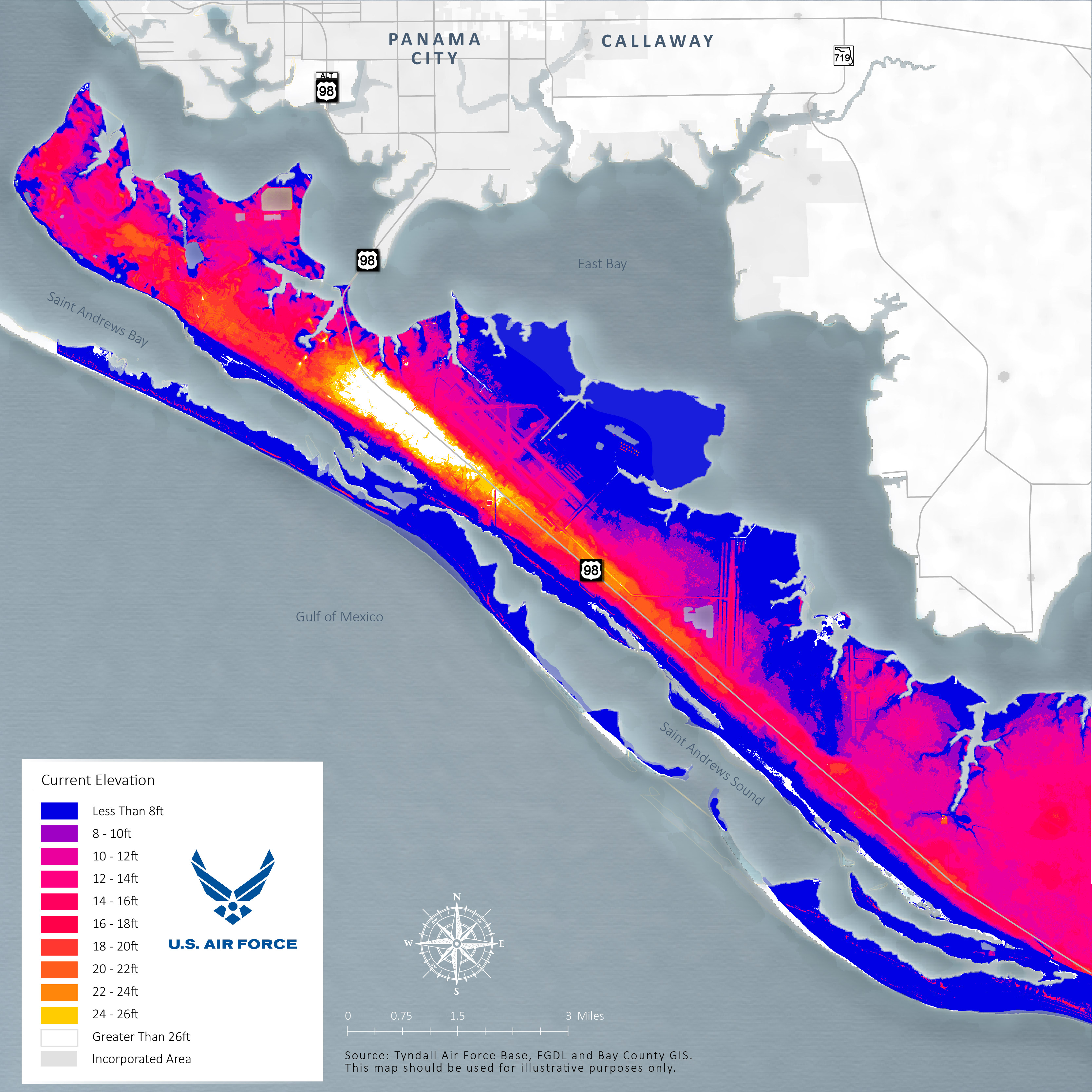
CURRENT ELEVATIONS
The elevation on the installation ranges from 0 to 30 feet, as depicted on this map, with the high point shown in white.
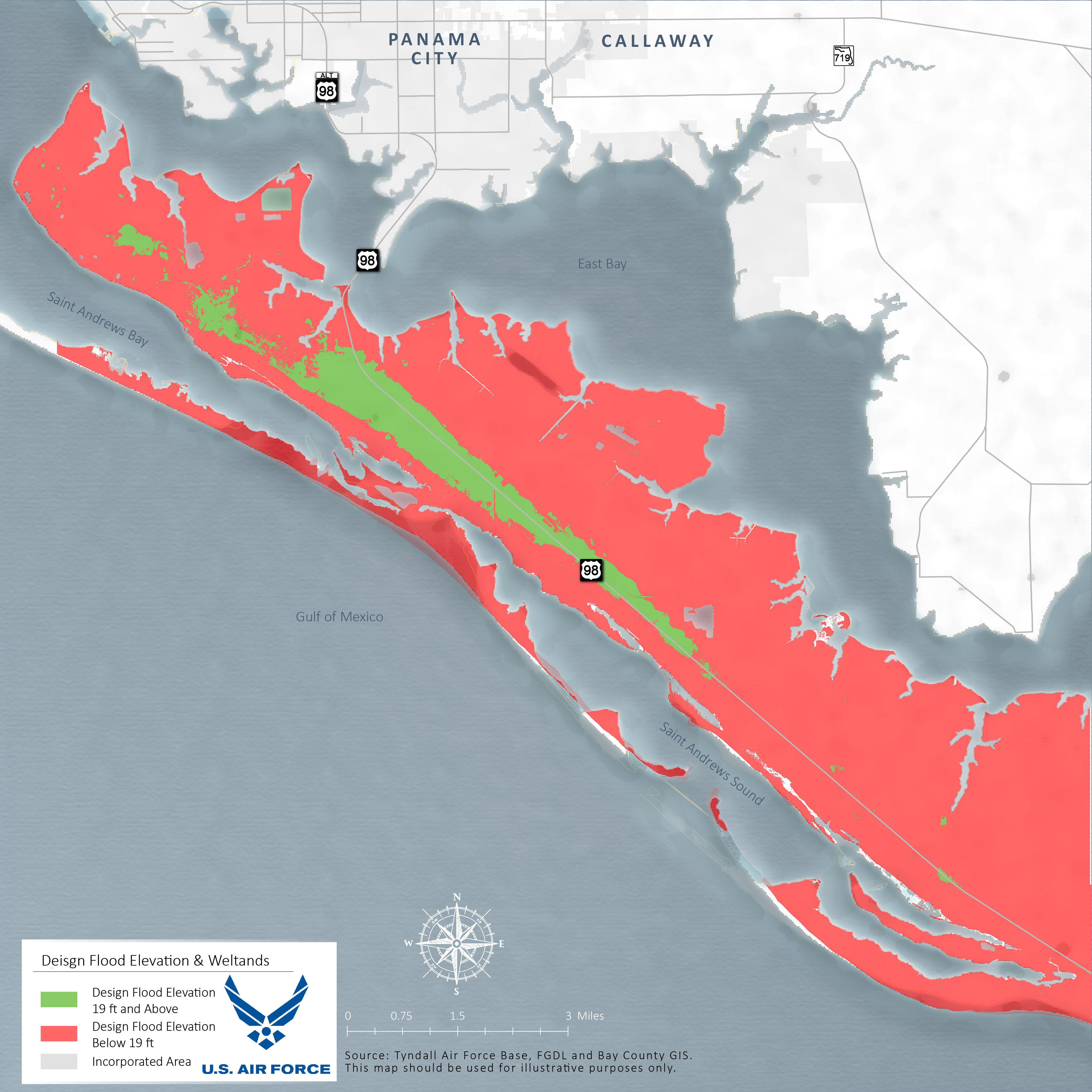
DESIGN FLOOD ELEVATION (DFE)
Based on the environmental factors shown previously, Design Flood Elevations (DFE) have been determined. This follows the Federal Emergency Management Agency’s (FEMA’s) definition of the elevation of the highest flood for which well-designed facilities can be protected. On the bay side, the DFE is 14 feet. On the gulf side, the DFE is 19 feet. The map to the left illustrates the land areas where the land elevation is 19 feet high or above. Areas that meet or exceed these criteria are highlighted in green, while areas lower that 19 feet are shown in red.
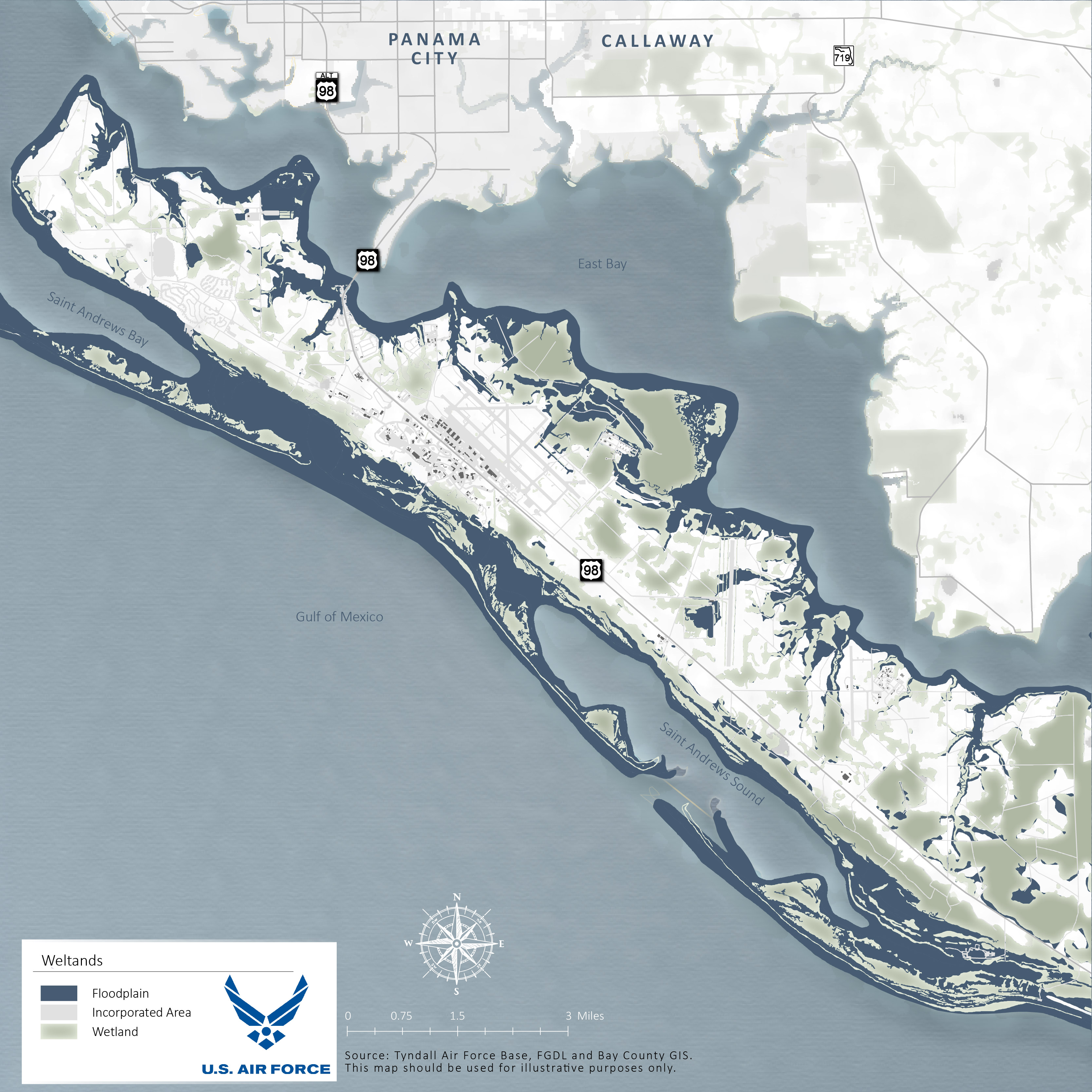
WETLANDS
Based on the environmental factors shown previously, wetland and floodplain areas have been determined. The map to the left geographically delineates the floodplain areas at TAFB and illustrates the wetland resources that are located throughout the site area.
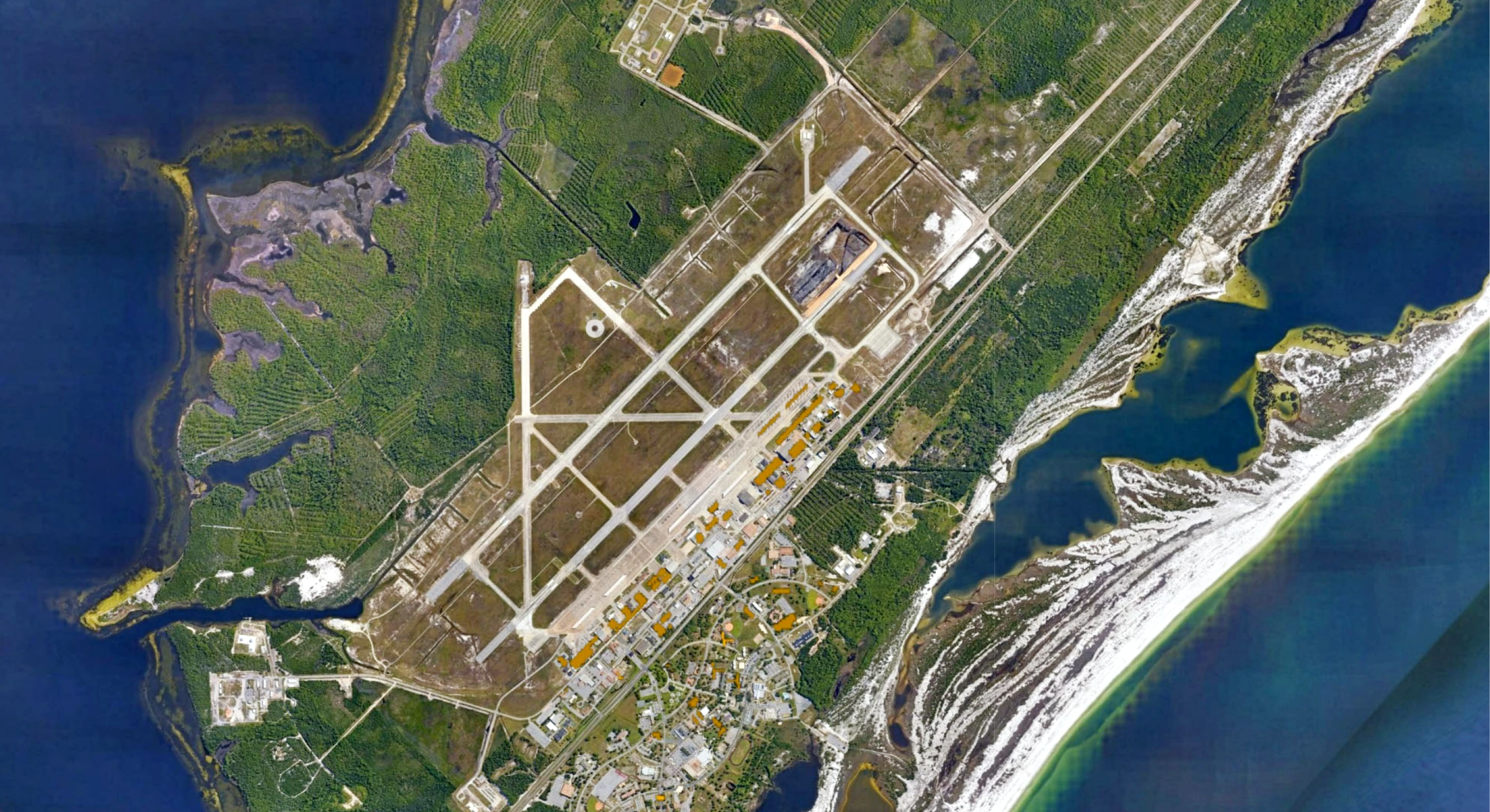
TYNDALL AFB
Tyndall AFB serves as a critical mission function training F-22 Raptor pilots and maintenance personnel to support combat Air Forces. The installation also supports headquarters for 1 AFNORTH, Air Control Squadron, 53 Weapons Evaluation Group, AFCEC, and others. In March 2021, a Record of Decision was issued by the U.S. Air Force, making Tyndall AFB the official location to host three new squadrons of F-35A Lightning II. The F-35s are expected to be delivered to three fighter squadrons in multiple phases. The first aircraft planned to arrive in the Summer of 2023. The original installation has a dispersed development pattern. The flightline was developed based on the linear layout created by the boundaries of the runways and U.S. Highway 98. The areas around the highway were built in a suburban pattern with space between facilities. The housing area, located several miles to the west, is separate from other parts of the installation. Additional mission elements, including the drone runway and training area, are in isolated locations both east and west of the airfield. As a result, vehicles are required to move between housing and work and between the facilities.