Planning Districts
Tyndall's Land Management Districts
Tyndall AFB has been divided into a total of seven unique land management districts that serve to section the installation by land usage and function. Each district faces unique challenges such as elevation, wetland areas, and cultural resources from Native and African American cultural sites.
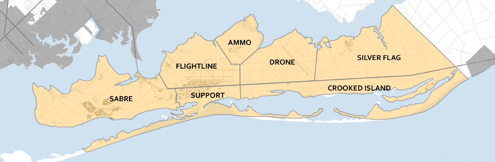
Flightline District
The Flightline District includes the airfield, taxiways, and flightline support. It is important for the district to be well-organized, easily navigable for multiple routes and modes of transportation, and designed with operational efficiency as a priority. The Flightline District is located between U.S. Highway 98 and the East Bay. The elevation at which its located, along with the operational constraints of the airways, poses unique challenges to the district.
Support District
The Support District provides amenities for Airmen, their families, DoD civilians, and military retirees. It is important for the district to be well-organized, easy to navigate, safe and secure, and have the day‐to‐day facilities the Tyndall AFB community relies on. The Support District is located between U.S. Highway 98 and the Gulf of Mexico. It consists of land on the Air Force Peninsula and Shell Island off the Peninsula. The abundant water and natural resources, including St. Andrew Bay, Gulf of Mexico, and Shell Island, present the Support Side with unique recreational and conservation opportunities.
Crooked Island District
The Crooked Island District is located between St. Andrew Bay and the Drone and Silver Flag Districts. Its elevation, along with operational constraints, pose unique challenges.
Ammo District
The Ammo District includes the Munitions Storage Area and surrounding open space. It is located between the East Bay and the Flightline and Drone Districts. Its elevation poses unique challenges to the district.
Silver Flag District
The Silver Flag District is located between St. Andrew Bay and the Crooked Island District. Its elevation poses unique challenges.
Drone District
Drone district contains a runway for drone training activities and otherwise relatively undeveloped.
Sabre District
Sabre District currently contains military family housing, MWR facilities, Boat Marina for POV use, and water treatment facilities for Tyndall AFB.